Don’t Roll the Dice—Do the Proper Analysis: Addressing Land Subsidence Geohazards for Innovative Infrastructure Design & Construction
If you’re designing and constructing infrastructure in certain areas of the U.S., there’s one big risk you can’t afford to ignore: land subsidence.
In various parts of the country—especially in the southwest—land is literally sinking underfoot. It’s happening in Arizona, for example, where groundwater depletion is causing the ground to subside, forming deep earth fissures and threatening buildings, roads, and bridges. Yet, despite these risks, infrastructure projects may still be designed and constructed without fully addressing the geohazards caused by land subsidence. The result? Crumbling roads, cracking foundations, and infrastructure that isn’t built to last.
The truth is, you can’t just roll the dice and hope your infrastructure stands the test of time. If the ground beneath your project is sinking, you need to know. That’s why conducting a proper geotechnical analysis is more critical than ever. Just ask NCS GeoResources President Naresh C. Samtani, Ph.D., P.E., BC.GE, F.ASCE, who recently did this in Arizona to ensure a new roadway bridge was built to withstand sinking ground.
A Bridge in the Making: How Groundwater Pumping Shaped A New Roadway
Naresh was tasked with performing geotechnical engineering services to support the design and construction of a new roadway in Glendale, Maricopa County, Arizona. Near Luke Air Force Base, the planned roadway would cut through farmland and scenic rose nurseries. It would also include a bridge passing over the Burlington Northern Santa Fe railroad. With fighter jets roaring overhead and eagles soaring in the sky, the location seemed like a picture-perfect spot. But there was one big problem lurking underground: land subsidence.
“You don’t see much greenery in our part of the world unless you’re near a canal, in a park or farm, or something similar,” Naresh explained. “We have water scarcity in Arizona, so we keep pumping groundwater. There were many private wells within a 2-mile radius of the project. That’s where people are pumping groundwater, and when we pump water from wells, the ground settles.”
To understand the extent of groundwater pumping in the area, Naresh and his team gathered groundwater level data. They found that pumping water from wells for agriculture and municipal use had significantly outpaced the rate of natural groundwater recharge in the last 100 years. The result? Severe groundwater depletion. In the 1920s, the region’s groundwater table was 50-70 feet below the ground surface. In the 1990s, it was nearly 500 feet underground—a result of dropping about 6.4 feet per year. While efforts to replenish groundwater had helped increase its depths to 225 feet – 350 feet below the ground surface in 2010, relentless pumping from wells was still an issue. Naresh simply had to determine how much this issue would affect the proposed bridge at this location.
Maps and Models Reveal a Deep Subsidence Bowl
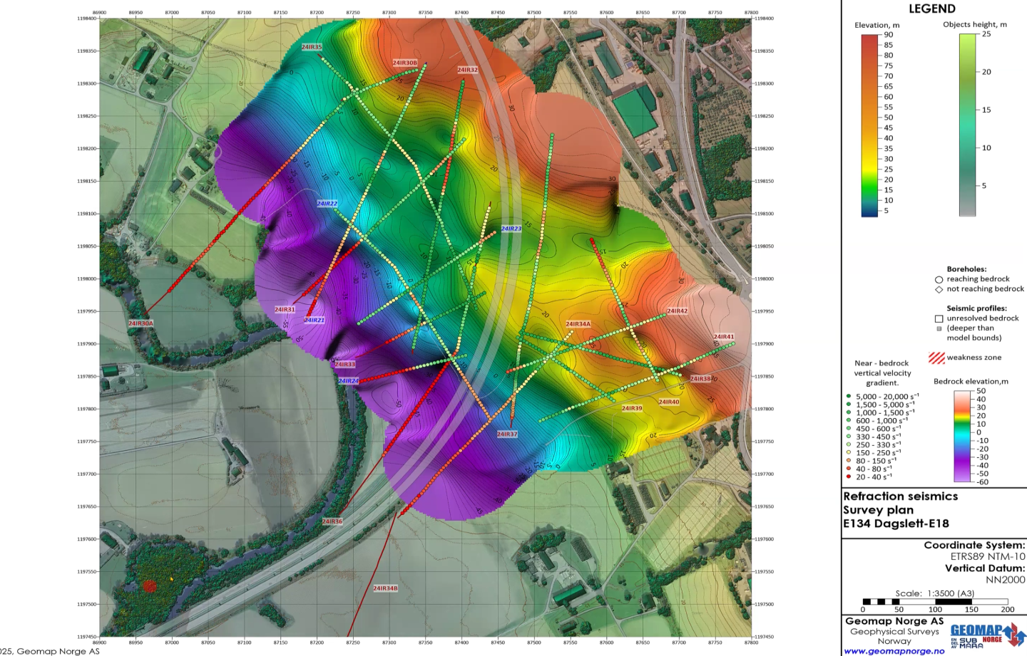
Naresh utilized Surfer to create contour maps to analyze how significant the land subsidence was, as it would inform the bridge’s design and construction. To create the visualizations, he relied on project-specific data and published data from the United States Geological Survey, the Arizona Geological Survey, and the Arizona Department of Water Resources. After developing the contour maps, Naresh saw that the land around the project had subsided up to about 18 feet in some areas. Even worse? The ground was still sinking. And here’s the kicker: the planned bridge was going right over the bottom of the subsidence bowl. In other words, the bridge would be built on land that had already sunk significantly and was continuously settling. Using Surfer, Naresh designed 3D models to provide a comprehensive view of the subsidence bowl and the bridge’s location.
With these insights visualized, Naresh could easily identify the complex stress and strain patterns caused by land subsidence, giving him the direction needed to help design and construct the bridge to withstand these challenging conditions.

A Bridge That Adapts to the Land: Designing for Movement and Stability
When it came time to design the bridge, Naresh knew a conventional approach wouldn’t cut it. The challenge wasn’t just building a bridge—it was building a bridge that could remain intact despite ongoing land subsidence. The ground beneath the planned infrastructure wasn’t static; it was continuously shifting and settling due to groundwater depletion. And since pumping groundwater was (and still is) a necessity in Arizona, the land would keep moving for years to come. The bridge, therefore, had to do something most bridges don’t: adapt to the shifting ground. Naresh’s solution? A truly innovative, flexible design that would allow the bridge to remain stable while the ground beneath it moved.
“We built 3D isolation systems in the form of flexible walls and uncoupled bridge abutments,” Naresh explained. “This protects the bridge structure from damage as the bridge itself and everything around it will keep on adjusting to the ongoing subsidence, making it a sustainable solution.”
Think of it as solving a real-life Rubik’s Cube. The ground beneath the bridge moves in all directions, but thanks to this unique design, the bridge won’t lose its structural integrity. It’s a smart, forward-thinking solution that ensures the infrastructure remains safe and functional—even as the land continues to sink.
Why Smart Infrastructure Design Is Critical in Subsidence-Prone Areas
Arizona’s land subsidence isn’t an isolated issue—it’s part of a larger problem in the United States. In semi-arid to arid areas of the southwest, the land beneath is sinking due to excessive groundwater pumping, and it’s threatening the future of infrastructure in many regions. With the rapid growth in the southwest, these problems will accelerate, requiring better technology to visualize and evaluate the subsurface conditions. As such, while it may be tempting to continue with business-as-usual construction practices and ignore the risks posed by land subsidence, that’s no longer an option. Naresh’s project shows that doing the proper analysis upfront with advanced technology is critical to designing and constructing infrastructure that adapts to shifting ground. You can’t solve a problem you don’t fully understand, which is why thorough analysis must be part of every infrastructure project in subsidence-prone areas.
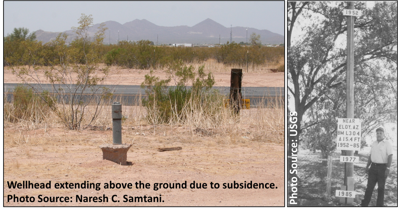
“The water level is going down so much that the wells we’re pumping water from appear to start coming out of the ground,” Naresh said. “Why is this happening? It’s not because the well is coming out of the ground; instead, the ground is subsiding around the well. You see this fellow here?” he asked, pointing to an image with Herb Schumann in it. “This was the surface level in 1952, and this is how much the ground has settled between 1952 and 1985. This subsidence also leads to the development of earth fissures that can be very deep. We have massive earth fissures here in Arizona, so the moral of my story is this: don’t roll the dice. Do the analysis properly and perform detailed studies. Using Surfer was a part of not rolling the dice.”
Recent Articles
- Apr 1, 2026|Gabbie Rhodes|10 min
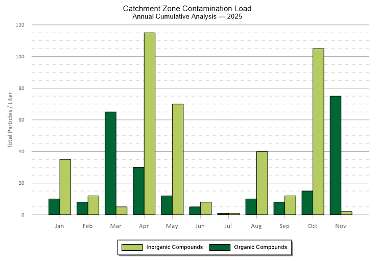
Grouped bar charts offer a distinct and powerful way to compare data. They can bring clarity to differences that might otherwise get buried.
- Apr 1, 2026|Gabbie Rhodes|6 min
From surface to subsurface features, Alexey Shulgin translates geophysical measurements into clear insight to drive stakeholders' decision-making.
- Mar 25, 2026|Gabbie Rhodes|10 min
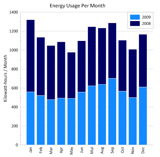
Stacked bar charts are one of those visuals that everyone recognizes but doesn’t always use to their full potential. Discover how to use it effectively.
- Mar 25, 2026|Gabbie Rhodes|11 min
One of the most common choices in scientific data visualization is deciding between a log scale vs. linear scale. Here's how to choose wisely.