Recreating a Lost Maya Fortress with LiDAR and Surfer
The ability of airborne LiDAR to ‘see’ through dense forest canopies and reveal long-hidden structures has revolutionized modern archaeology. Nowhere has the impact of laser scanners been more dramatic than the jungles of Guatemala where scientists are gaining new insights into the culture of the Maya people – with help from Surfer’s 3D visualization capabilities.
LiDAR Blazes a New Path For Archeological Studies
The palaces, temples and grand avenues of Chichen Itza, Tikal and other ancient Maya cities throughout Central America have been well documented through traditional archaeological methods. The smaller, less grandiose structures in the outlying areas between the large cities, however, have been largely understudied, primarily due to the expense and difficulty of finding and excavating them.
This is a shame, according to Garrison, because these are areas where normal people went about their daily lives. He theorized these ‘suburban’ sites might yield valuable – and previously unknown – information about Maya culture. With several archaeology colleagues, Garrison proposed an extensive LiDAR to PACUNAM, a non-profit foundation based in Guatemala focused on preserving the country’s cultural and natural resources.
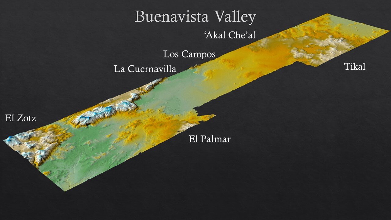
“[Until then,] LiDAR projects had focused on small-area collects over specific sites,” said Garrison. “We expanded that approach to a massive scale over 2,100 square kilometers [collected in ten different areas across northern Guatemala].”
“LiDAR really set our field alight,” said Tom Garrison, Assistant Professor, Department of Geography and the Environment, University of Texas at Austin. “In a single flight path, LiDAR can reveal what would take years to map on foot.”
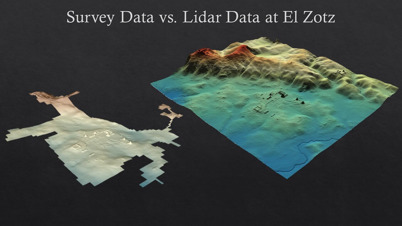
The airborne LiDAR data revealed a stunning find: A huge fortress stretching more than two kilometers in length lay hidden in the jungle just 15 km west of Tikal. Amazingly, Garrison had scouted within 100 meters of the fortress wall a few years prior without seeing it through the dense vegetation.
Revealing the site, now known as La Cuernavilla, involved several steps. After acquisition, the raw LiDAR files were processed at the National Center for Airborne Laser Mapping in Houston, where several products were generated including a bare-Earth digital elevation model. The DEM is a point cloud representing elevation points for the ground and features on it. Vegetation has been digitally stripped away from the scene.
Garrison uses several software packages for analysis, but his favorite for 3D visualization is Golden’s Surfer gridding, modeling and surface mapping package.
“Surfer is amazing for quickly re-rendering a new image after editing point cloud values,” he said.
The most useful Surfer functions for bringing La Cuernavilla to life have been the 3D viewing tools. Some of the fort’s features date back more than 1000 years, which means erosion has taken its toll on the limestone and earthworks structure. To highlight the relief of ditches, ramparts and walls, Garrison adjusts the Z values in Surfer, which accentuates the profiles of once striking vertical features that are now dulled by weathering and sediment accumulation.
“The way Surfer renders in 3D maintains the integrity of the resolution without pixilation,” he said, adding that he has created a stunning video of the fortification from inside the landscape with Surfer’s First Person View tool.
Garrison will visit La Cuernavilla in summer 2021 to begin interpreting what the fortress means for the region. From a military perspective, the site already challenges traditional orthodoxy regarding Maya warfare. In more general terms, the density of housing structures and other features found near the fort may reveal an understanding of Maya agriculture and adaptation to a changing climate not previously known.
Golden Guarantee
100% Satisfaction Guaranteed or 100% of Your Money Back
We know Surfer and Grapher’s visualization capabilities will help you stand out from the crowd, WOW clients, and leave a lasting impression!
But… we realize you don’t know this yet. And you won’t until you experience our products for yourself.
This is why we provide this guarantee. This is the distillation of a 40+ year adventure designing, developing, and honing powerful visualization and analysis features as requested by scientists and engineers like you.
Our products can produce results far beyond its license fees. We are assuming all your risk, so you have none.


