The Wonders of Patagonia: Exploring the Massive Region Stretching From Chile to Argentina
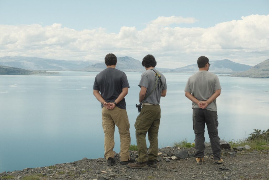
One of the best perks of having friends getting married in other countries is the built-in opportunity to travel—and that’s exactly the opportunity Grapher Product Manager Santiago Vivas embraced alongside several adventurous friends. This trip wasn’t a spur-of-the-moment idea; Santiago and his fellow travel enthusiasts had always known this day would come. One of their close friends (a member of their travel group) would likely get married in Argentina, and they’d all made a promise: when the big day arrived, they wouldn’t just attend the wedding—they’d also embark on an unforgettable adventure to one destination in particular: Patagonia.
Patagonia: A Land of Vast Wonders
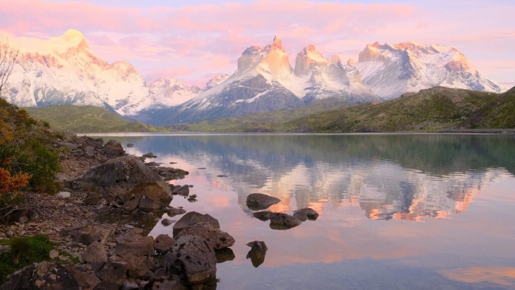
Stretching across the southern reaches of both Chile and Argentina, Patagonia is a region tailor-made for adventure and awe. Covering over 1 million square kilometres, it’s bigger than 80% of countries on Earth and teeming with diversity. From jagged peaks crowned with glaciers to sprawling grasslands and shimmering blue fjords, Patagonia’s landscapes are as dramatic as they are breathtaking. It’s home to some of the most iconic natural wonders in the world, including the towering spires of Torres del Paine, the massive Perito Moreno Glacier, and the windswept steppes of the Patagonian Desert.
But what’s it really like to travel through this vast, untamed wilderness? That’s where insights from Santiago come in. Fresh off his journey to Patagonia, Santiago shared his thoughts, stories, and favorite moments from his trip. From exploring stunning landscapes to tackling the unique challenges of traveling through such a remote region, here’s all the insights he offered.
1. Let’s start with your general impressions. How was your trip overall?
It was absolutely incredible. Honestly, we got really lucky—the weather was perfect the entire time, which is one of the most unpredictable things about Patagonia. Everything just seemed to align. We had the right gear, the right conditions, and everything went smoothly.
One unique aspect of this trip was traveling with a friend who brought along their 7-month-old baby. It was a big deal for me personally because this friend group has been traveling together for years. When someone has a baby, you wonder if that’s the end of the adventures—but this trip proved otherwise. It felt like a milestone, showing us that we could still travel together. We all pitched in to help carry the baby up the mountain, and it went really well. It gave me hope that we can keep making these trips happen before life gets even more complicated.
2. You visited the Chilean and Argentinian sides of Patagonia. Tell us about the trails in Chile. Which ones did you explore?
On the Chilean side of Patagonia, there are two iconic trails: the W Trek and the O Circuit. They’re named for their shapes—the W resembles the letter, and the O is essentially the W plus a loop around the back connecting the outer legs to ultimately form an O. The two trails are basically on top of each other, offering various options for hikers. During our trip, we did one leg of the W. It was about 14 miles and took nearly 12 hours. But the full W trail usually takes around 4 to 5 days to complete, while the O can take 6 to 10 days.
3. How was the Patagonia region in Argentina? What trails did you hike there?
Interestingly, while the Chilean side of Patagonia tends to be more famous among serious hikers—thanks to iconic spots like Torres del Paine—the Argentinian side has its own claim to fame. Mount Fitz Roy in El Chaltén is actually the logo for the Patagonia clothing brand. Another fun fact is that Mount Fitz Roy is named after the captain of Charles Darwin’s ship, the HMS Beagle. There’s a lot of Darwin history in the region, too. As I explored, I kept stumbling upon places named after him, like Darwin’s Pass, Darwin’s Cabin, and Darwin’s ostrich!
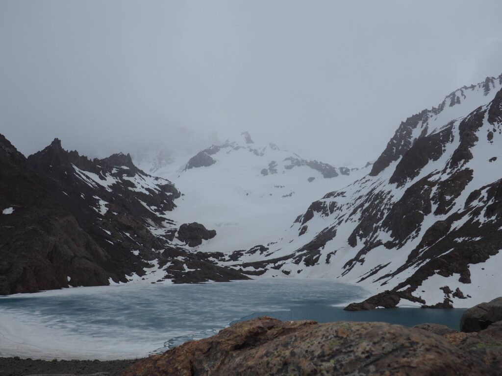
On the Argentinian side, we did the main hike called Laguna de los Tres, which translates to “Lake of the Three.” Because my two brothers were also on this trip, it was pretty surreal for us to do a trail named the Lake of the Three. This hike leads to a stunning glacial lake with Mount Fitz Roy as its backdrop—but like most visitors, we weren’t able to see the mountain. It’s very rare to see it, but even without the full view, it was still super cool. This trail was also about 14 miles and took us around 12 hours. Most of it was fairly easy, but the final stretch was challenging.
4. What made the last half of Laguna de los Tres so challenging to hike?
The hike starts with a slight uphill push, followed by a long, flat plateau that makes most of the trail easy. But the last stretch is where it gets intense. The final ascent is incredibly steep—about a mile and a half long with what felt like 3,000 feet of elevation gain. It was extremely challenging going up, and the descent was also tough. Since it was so steep, my knees felt like they were on fire.
Despite the challenge, the journey was still enjoyable. We stopped frequently to take in the nature around us, and our friend’s baby was happily along for the ride in a little backpack carrier. He seemed to love it—the rhythmic walking put him to sleep almost the entire time, but his parents didn’t take him up the final steep ascent.
5. You saw beautiful glaciers during your trip. What was that experience like?
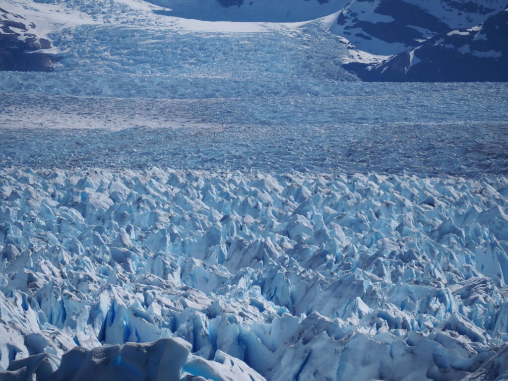
At the start of our trip, we visited an incredible glacier in Los Glaciares National Park —it was absolutely amazing. Standing in front of this massive glacial field was awe-inspiring; it’s surreal to see the sheer scale of a glacier up close. It really makes you pause and think, “Wow, so that’s what a glacier looks like!” Surprisingly, though, it wasn’t as cold as you might expect. Since it was summer, I was comfortably hiking in a T-shirt most of the time.
6. What type of wildlife did you see?
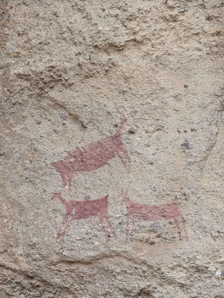
We saw guanacos everywhere. They’re relatives of llamas and alpacas and are members of the South American camel family. Unlike llamas, which are often used as pack animals, and alpacas, which are prized for their wool, guanacos are primarily a source of food in the region—and they’re everywhere. But for the most part, we mainly saw amazing bird species, including penguins and a type of ostrich. Sadly, we didn’t spot any pumas or deer, which are known to inhabit the area, but the diversity of birdlife more than made up for it.
7. Tell us about the birds in Patagonia. What did you see, and which species impressed you the most?
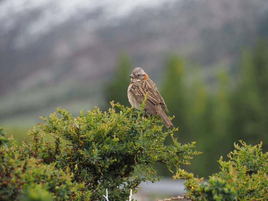
I spent a lot of time photographing birds on this trip, capturing as many as I could and cataloging them with an app called Merlin Bird ID, which uses image recognition. The app is pretty cool—you snap a photo, and it’ll identify the bird and add it to your log. By the end of the trip, I had cataloged 54 different species, which was definitely a highlight for me.
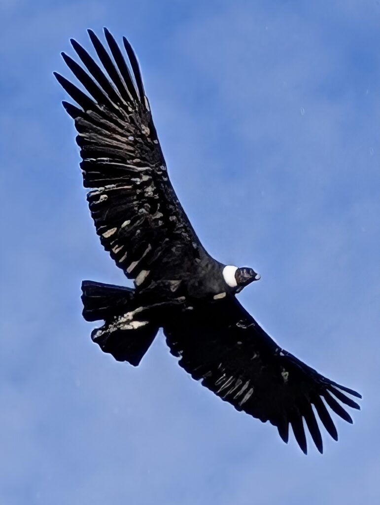
One of the most impressive birds was the Andean Condor. We spotted it on a smaller trail near some cliffs in El Chaltén, not far from the first-level hiking area. These birds are absolutely incredible—truly majestic. They’re massive, standing a little over 4-feet tall, and they’re actually the national bird of Colombia. Seeing one up close, just perched on the ground, was unforgettable, especially since it’s hard to see this bird in Columbia due to difficult situations happening in the country’s mountain regions.
8. What about the plant life—what did you see?
Honestly, it’s more about the lack of plant life. Patagonia’s environment is harsh, with very little vegetation. There are trees, but not much else that thrives in such extreme conditions. We asked about the guanacos—how they manage to survive—and learned that many of them actually die from starvation. They feed on grass, which is plentiful in summer when everything looks lush and green. But winters are long, and much of the vegetation dies off.
What’s fascinating is that guanacos have been around for ages. We visited a cave where the bones of a prehistoric giant sloth were discovered, along with a timeline showing when certain animals coexisted. Guanacos have outlasted saber-tooth tigers and other predators that once hunted them, which is pretty incredible. Despite the lack of food and their defenseless and somewhat awkward appearance, they’ve figured out survival where so many other animals haven’t.
9. Did you see any historical artifacts or evidence of ancient civilization in Patagonia?
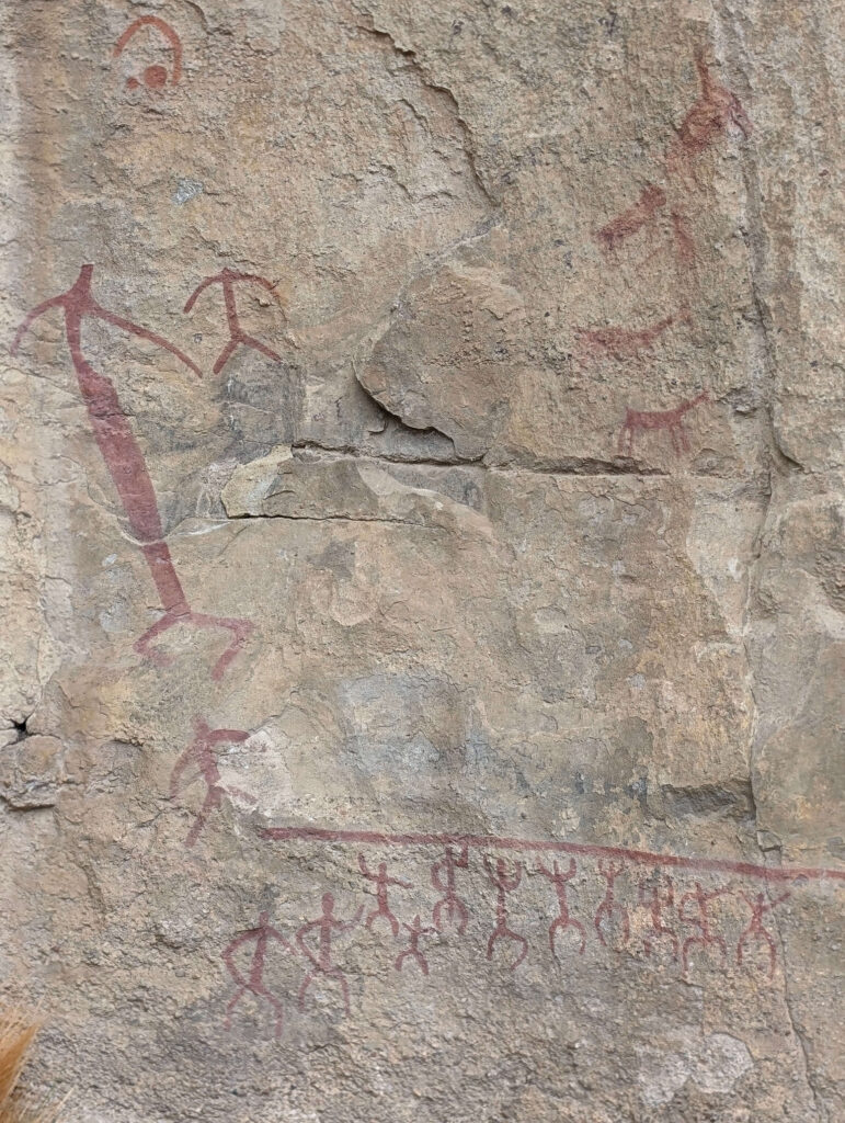
Yes, we came across some fascinating evidence that hinted at ancient civilizations in the region. I focused on capturing photos of the more recognizable ones—things that were easier to interpret. The most intriguing piece was a cave painting depicting a large, stretched-out human figure, a group of people, and a herd of animals. It’s believed to illustrate a group cheering on a first-time hunter who’s crossing a hilltop. The long shadow cast by the figure is scaring herds, while others wait on the far side to flank the animals. It was like witnessing a scene frozen in time, showcasing the ingenuity of early humans in the region.
There was also smaller, less obvious historical evidence scattered throughout the area. While they were interesting, the cave painting was especially cool because it captured a whole story in a single image.
10. What was the geology and geography like?
The geology in Patagonia is stunning and so distinct from what you’d see in the United States. Right away, I noticed how much more jagged and spiky the mountains were compared to the Rockies or even the Appalachians. After a quick search, I confirmed why: Patagonia’s mountains are younger, so they haven’t eroded as much. That’s really what you go to see when visiting the region—it’s all the spiky, jagged tower-looking mountains that haven’t eroded when compared to others.
Glaciers also play a huge role in shaping the landscape. The region is full of them, and the ones left are all remnants of a massive continental glacier that covered the entire Patagonian cone in the ice age, which was responsible for the caves, valleys, and cliffs. Another cool thing is that many of the glaciers in Patagonia are still growing, unlike most in the world. It’s a reminder of just how unique and dynamic this part of the planet really is.
11. Final question: if you could create one graph in Grapher inspired by your trip to Patagonia, what would you design?
I’d make a graph that shows the birds I logged and that ranks them by rarity! The birds were a highlight of the trip and one of my favorite parts.
A Journey Worth Taking
Patagonia is a land that truly has it all—jagged peaks, sprawling glaciers, fascinating wildlife, and a rich history. Santiago’s adventure through it offers a glimpse into the many rewards that come from exploring this vast wilderness. From steep ascents to cataloging rare birds, every moment was filled with discovery and awe, and ending the trip with his friend’s wedding was even better.
For more insights into some of the world’s wonders our team is checking out, stay tuned for future blogs! In the meantime, have you traveled to any parks or regions so majestic that you’d like to visualize their highlights? Use Grapher to design and customize a graph that clearly and beautifully showcases the interesting insights from your trip!
